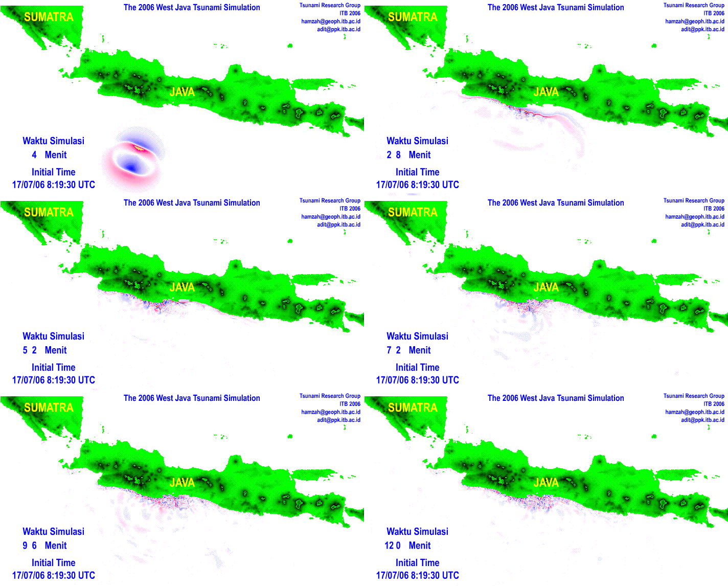
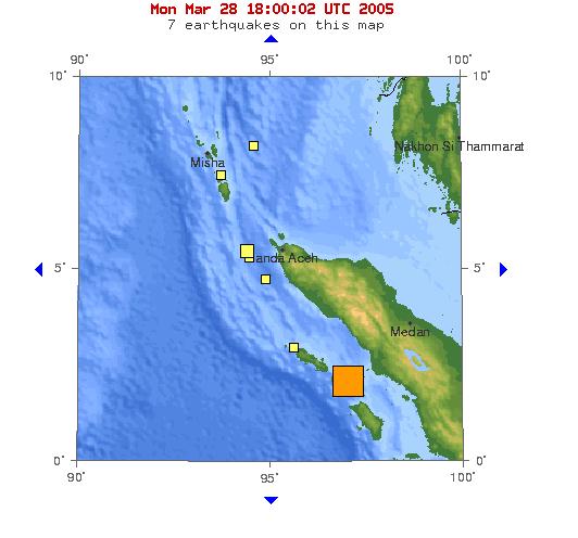
This was produced within 2-1/2 hours of the actual event based on reports from wave height and runup at Pangandaran, so we can expect some refinement as more data on the source mechanism and actual crest heights and runups are reported.

The meeting iwas to look at what the deposits left by a tsunami can tell us about the event itself.
A friend to whom I mentioned this said Tsunami deposits? You mean, like, 'bodies and hotel furniture?' Umm, well, no - the deposits are mostly rocks, sand and mud. The basic question is what can the deposits tell us about the frequency of these events, and about the tsunami's speed, direction, evolution, and maybe even what caused it. As my friend well knew, these deposits are laid down in many areas that did not have resorts.
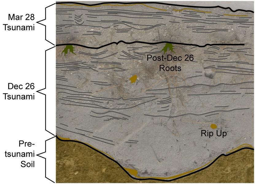
Here's a tsunami deposit, from a beach in Indonesia hit by both the December 2004 and March 2005 events. The photo was taken by one of the International Tsunami Survey teams, and given to me by Lori Dengler:
The hope is tha by looking at grain sizes, distributions, mineralogy, etc. that we might even be able to date and locate sources of tsunamis in order to get a better handle on local frequencies for these types of events.
The group meeting here is a sampling of the world's expert sedimentologists, geologists, geophysicists, hydrodynamicists, numerical modelers, database experts, etc. etc.
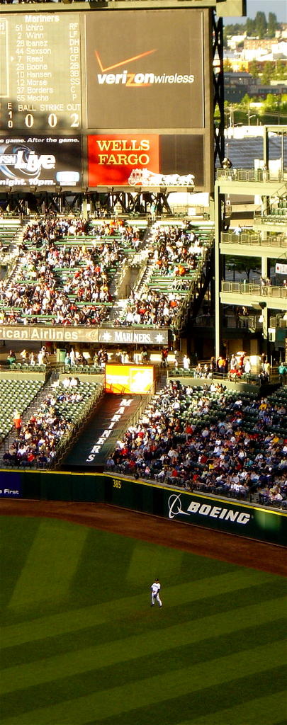
As part of the social events, many of us went to a Seattle Mariners baseball game on the evening of June 14 at Safeco Field (and this really does have to do with the topic...):

For our Japanese participants, the highlight of the game was when we saw Seattle's Ichiro hit his 1000th base hit, and of course to see him in right field: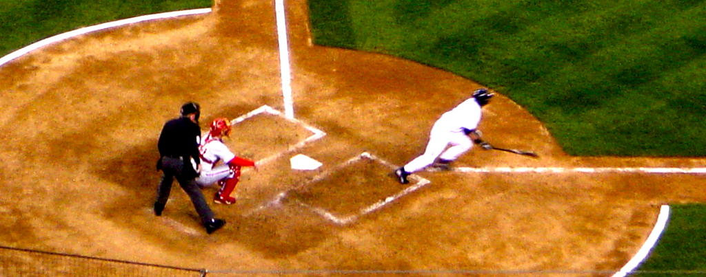
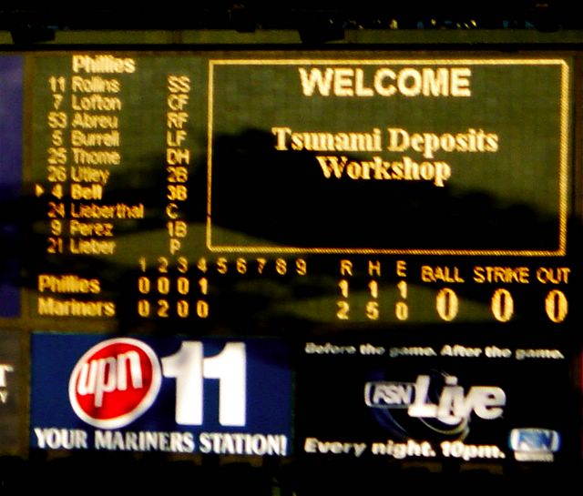
It was also nice to be electronically welcomed to the stadium - although any fans paying attention to the scoreboard were probably also confused as to what, exactly, tsunami deposits were:
Well, during the latter part of the game, all of the sudden our group's cell phones went off like crazy. A large-ish earthquake had just occurred off the coast of Oregon, triggering a tsunami warning along the Western coasts of the U.S. and Canada. And, of course, the world's top tsunami specialists were all sitting at Safeco Field in Seattle, drinking beer.
We got the details from the callers (including some family members in Oregon who were being directly affected), had a quick discussion, decided the tsunami risk to the West coasts was minimal, and returned to drinking beer, talking to friends, and oh yes, occasionally watching baseball like the rest of the crowd. Why minimal? Because this was an earthquake in the middle of the Gorda plate, and was therefore very likely strike-slip rather than a thrust event - which meant that the amount of motion on the seafloor that displaced water was probably very small. This meant that the resulting tsunami would be very small (and in fact 20 minutes later, when the tsunami arrived, the tide gauges at Cresecnt City and Eureka measured less than one inch). Here's the location of the earthquake: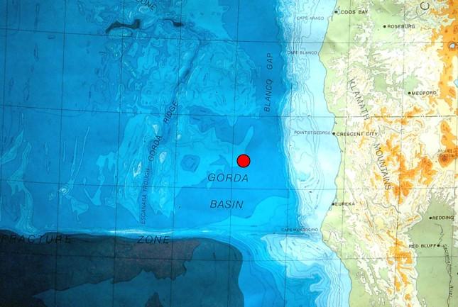
However, the lesson here is not one of complacency - there is a lot of evidence showing that the Pacific Northwest has been hit many times by tsunamis at least as big as the 2004 Indian Ocean event. And, like Indonesia, Washington and Oregon States will bear the brunt of the waves, with little to no time for evacuation. Here are maps showing the tsunami-genic Sunda and Cascadia subduction zones off Sumatra and the U.S.-Canadian West:
We left that game a fair bit later (Seattle won over the Phillies), and contemplated the brooding stadium next door in a strange evening light. Conversation ensued about how a city could get itself into such a political tangle that it accepted the building of two stadiums where one would have sufficed. Since I am from Washington DC, I kept my mouth shut.

Sure enough, the next morning the meeting was crawling with news media looking for the experts. This is the NBC Evening News crew's cameraman, filming one of the speakers:
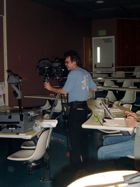
The result: some good pieces in the print media, and about ten seconds on the national news. Not bad, especially considering that the local authorities in Oregon got creamed for a failed radio alert network, and not being able to control the curious public who went down to the beach to watch for a tsunami.
The result from the workshop? A lot can be learned locally about effects and history of tsunamis, but the records are so heterogeneous and dispersed (especially the paleorecords) that putting together a picture of the source mechanism is proabably beyond our reach. Even in the best possible conditions, there is little chance of reconstructing the event itself. Even knowing the date and location of the events in December and March in the Indian Ocean, we would probably not be able to distinguish two separate events in the deposits a few years later, so the distinction in the photos at the top of this post would disappear. In addition, we know the topography enough to model wave run-up on land, and we know the deep-sea bathymetry well enough to model tsunami propagation, but we do not know the near shore bathymetry well at all - and that is critical for matching the models of deep-sea wave propagation with the on-shore run-up.
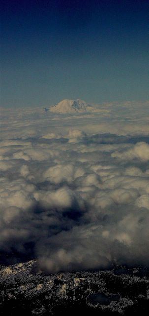
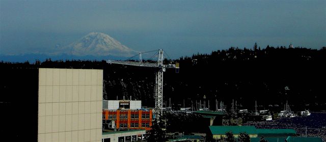
And Seattle? Seattle was left peacefully as before, waiting patiently to be swept away by a tsunami or buried in volcanic ash. An idyllic view from office windows at the University of Washington.


In this case, a 30 cm layer of lighter-coloured sandy tsunami deposits overlies the previous darker-coloured soil surface. Jody showed similar sections from the West coast with grey tsunami deposits sandwiched between the pre-existing soils and the later, younger soils on top of them (in the above photo, the younger soils overlying the tsunami deposit have not been deposited yet, since the tsunami occurred so recently).
As you might imagine, Jody is in great demand these days, and is in Washington DC to speak at a Smithsonian press event tomorrow morning at the Willard. She has been dealing a lot with public misconceptions about tsunamis, and she spoke to us about the threat to the Atlantic coast.
One item she mentioned was the threat from the cataclysmic collapse of the Cumbre Vieja volcano in the Canaries, much quoted in the press, and parroted by me here. It turns out that the model producing a 25 meter high wave on the East coast is a model by Steve Ward at UC Santa Cruz (you can see a set of Steve's powerpoints on landslide generated tsunamis here, including diagrams of the Cumbre Vieja predicted wave). Of course, disasters make for good news, so the work by Steve on the tsunami and by Bill McGuire of the Benfield Greig Centre in the UK on the collapse of Cumbre has been played up a fair bit by the press.
This much, at least, is still science. On to the outright fakery portion.
Immediately after the Sumatra event, all sorts of photos emerged purporting to be of the tsunami. Fortunately many of them were real, which can help educate people on what to do in this situation, and to document what happened. Others were outright fakes that only serve to propagate misconceptions. Jody used the following example in her talk that I had seen floating around on the internet, and which I had tried to stamp out as well as I could by telling people it was a fake (the red letters are mine, more below on that...).
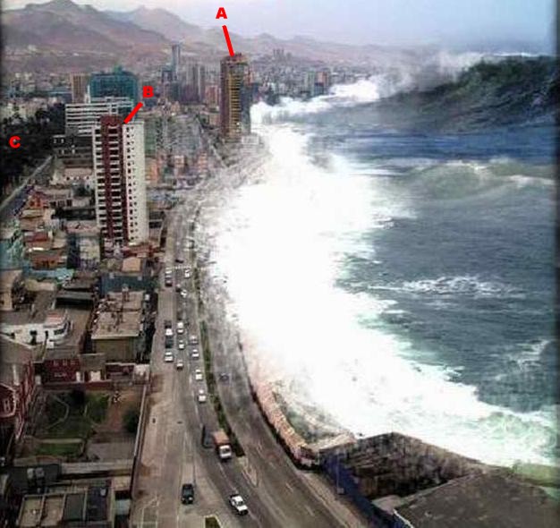
I hadn't paid much attention to it in the last few weeks until I saw it again, up on the big projection screen, and it screamed out "South America" to me. I don't know exactly why, but something in the architecture, setting, etc. just made me think the city was in Latin America. At first I thought it was Bogota, because one of the buildings looks somewhat like the Tequendama Hotel, and a far off building looks like the Avianca skyscraper, but there were still several things wrong for the skyline to be Bogota.
A quick search on Snopes.com identified this tsunami picture as a known fake - and pointed to a what they claim as the source for the original photo of the Antofagasta skyline at World City Photos:

Sure enough, this photo by Christian Lantadilla is of the same scene. However, I do not think this is the photo that was used in the fake.
To confirm this, I did a bit more searching myself. First, are the two photos Antofagasta at all? Sure enough, there is a giveaway photo of the Antofagasta waterfront here, in an artcle in Realidad, a Chilean magazine. Here is the photo:
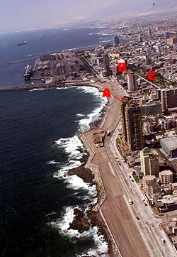
I have added letters to identify several landmarks. The fake tsunami and Lantadilla photos are taken looking South, with the city to the left. The Realidad photo is taken looking to the North. The letter "A" marks a tall building with yellow and red bricks with a characteristic roof shape. "B" indicates another building with characteristic red and white brickwork, while "C" indicates a park area.
But back to the difference between the tsunami and Lantadilla scenes of Antofagasta. As can be seen in the Realidad picture, it is very probable that the other photos were taken from the dark building at the end of the road just to the left of the "B." My guess is that these two photos were taken from different floors, at different times.
First, look at the mountains and the air and light surrounding them. The lighting and visibility is totally different between the two pictures, and this is not something easily changed with image processing - nor would there be a motive for the person faking the tsunami to put the work into changing the apparent visibility. The Lantadilla photo was taken on a clear, sunny day, while the fake tsunami background was taken on a more overcast, flatter lighted day. On the street next to the park there are tree shadows in the Lantadilla photo that are not present in the other (there is also a vehicle on this street in the tsunami picture that is not in the Lantadilla photo).
Second, the parallax in the photos is different. My guess is that the fake tsunami photo was taken from higher up, and more to the West (seaward), than the Lantadilla photo. It's difficult to tell with the images here, but if you download the originals, you can tell that the red & white brick building shifts ever so slightly against the more distant buildings behind it when you alternate between the two photos. You can see more of the roof (upwards motion) in the fake photo, and the red brick stripe moves leftwards against the building in the background (seaward movement of the observer). In this area there are several other inconsistencies - a possible reflection in the blue-glassed building that is either not there or due to intervening construction between the two photo times, and construction or modifications on the grey building that extends from the red & white to the park area.
I'm convinced that a) the tsunami photo is fake, b) the background is Antofagasta, and c) the fake was not made with Christian Lantadilla's photo.
In the end, what is wrong with the fake photo's water? Why couldn't this be a real tsunami in Chile? First is the scale - look at the height of that wave - it's taller than some of the apartment buildings. Only a major asteroid impact would give that kind of height. A tsunami is a low wall of water that simply keep on coming - sort of like a step function, and not a tall curling wave. Second, the scale of the features in the wave is wrong - look at the ripples and the foam - they just look wrong compared to the size of the cars. Now - there have been tsunamis in Antofagasta, with 1995 being the most recent - but they NEVER looked like this. This is not what a tsunami looks like - at a distance, tsunamis look harmless enough for you to simply stand there and watch. ...and take photos. ...and wait. ...and film. ...and suddenly realize that there is a river of seawater coming for you!
I had to chuckle as I was putting this post together: "Realidad" is Spanish for reality, or truth.

The India and Australia plates are moving northward, and are shoving under (subducting) the Burma microplate. Here's a schematic of the setting, with the India/Australia plate on the left, moving to the right and under the Burma microplate on the right:

The movement occurs in sudden bursts -- earthquakes. Like banging a tray full of water, if the earthquake moves the seafloor, it sets off waves -- tsunamis.
Here is one of the early simulations done of the tsunami by the Japan National Institute of Advanced Industrial Science and Technology:

And here is another simulation of the Sumatra-Andaman tsunami done by NOAA. Notice the reflections off and refractions around India, Diego Garcia, the 90 East Ridge and the Maldives! These reflections and refractions can focus energy and cause the tsunami to be very high on some shores and not so high on others - so the threat is not uniform along all shorelines. Note that Australia's West coast is much closer to the initial movement than Kenya, but it got almost no resulting wave.
The Geological Survey and Caltech's Seismo Lab produced a first estimate of the amount of the slip along the fault of the great Sumatra-Andaman Islands earthquake:

The red star is the location of the hypocentre - where the earthquake began. The black line is the surface location of the subduction fault (the trench), colours show the amount of displacement in cm of the hanging (upper) wall of the fault relative to the foot (lower) wall. Note that most maps show the hypocentre as if this was where all the action was, but that a lot of the motion of the seafloor was probably several hundred kilometers to the Northeast (and in fact, later modelling shows that there was significant motion even up into the Andaman and Nicobar Islands). This difference between the location of the hypocenter and the main displacement values is typical - and misleading.
Now it becomes obvious why the North-West of Aceh got hit so hard - the largest slip is 200km farther up the peninsula than the hypocentre.
Note that even in this preliminary model, an area of about 1200 km by 100km has moved several meters. This resulted in several meters of seafloor uplift (and displaced water, creating the wave). The total energy released was estimated at 3.57X10^29 dyn.cm in 200 seconds, with a peak slip of about 20 meters. (Chen Ji, Caltech).
There were at least fourteen aftershocks larger than magnitude 6.0, and one larger than 7.0 (all of these respectable 'quakes on their own).
This was enough to cause a 22cm wave in San Diego harbor, 2.6 meters in Manzanillo, Mexico due to focusing effects, and several days of tidal height disturbances as the sloshing continues to reverberate around the ocean basins.
Movie of the Andreanof tsunami movie
- moves much more slowly in the shallow waters north of the Aleutians
- reflects off/refracts through the Hawaiian/Emperor chain - the BC coast gets hit twice: once directly, the second time as a reflection off the Hawaiian seamounts.
What it looked like on the ground in Thailand (Aftonbladet, 8.0 Mb .mov file)This is a different angle from a clip that received a lot of air time. During the second surge, off to the lower left while looking out to sea, one can see a couple behind a palm tree trying to get out from behind a pile of debris blocking the surge and into the bar area. As with the shot from the other angle, I'm not sure they made it before the debris collapsed onto them, and pinned them under tons of rushing water. This is a horrendous example of how innocent looking water can quickly turn deadly. This begins as an interesting video, and quickly becomes quite frightening.
Links:
There is a lot of talk now about an Indian Ocean Tsunami warning system, and support from the U.S. Government for a global system that will include the Atlantic too. Perhaps a good idea, but several things should be noted. The frequencies of tsunamis in these two other oceans are very much less than in the Pacific - so there is a very high probability that the systems will never be used. On the other hand, the process of preparation of such a system reduces societies' vulnerability to many different types of hazards at the same time, so while we may not use them for saving people from tsunamis, we may end up using them to save people from other types of disasters. The last thing is a comment regarding tsunamis - even if there had been a fully operating system in place (which includes not only an earthquake detection system and a wave detection system, but more critically an information dissemination and public evacuation plan), the system would have done nothing to save Aceh or possibly even Thailand, since the wave would have reached them before any possible plan could have been activated.
Here is an amazingly prescient paper published in the September 2004 issue of Geoscience Australia magazine about an Indian Ocean tsunami warning system: AusGeo News 75 p.4 (part 1, with the referenced article, is a 3.9 Mb PDF file)
The best advice: if you see the sea withdraw, you can be guaranteed that it will be coming back with a vengeance. Run for the hills.
And finally, a word about feral goats in the Andamans, who, I would bet, are still there.
